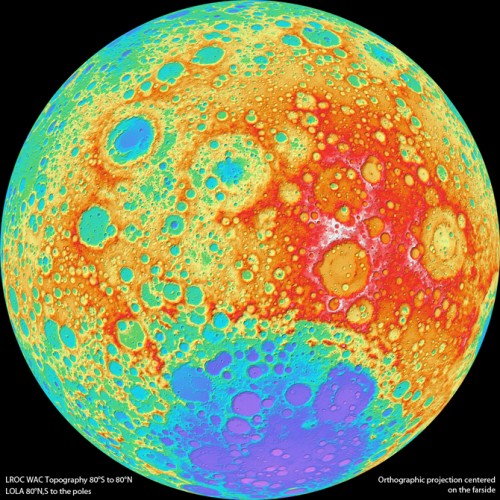
The most detailed moon map yet has been constructed from images by NASA’s Lunar Reconnaissance Orbiter (LRO). Technicians from Arizona State University compiled the map which shows elevation changes as small as 100 meters.
The near-global topographic map was constructed from 69,000 WAC stereo models and covers the latitude range 79°S to 79°N, 98.2% of the entire lunar surface. Due to persistent shadows near the poles it is not possible to create a complete stereo based map at the highest latitudes. However, another instrument onboard LRO called LOLA excels at mapping topography at the poles. Since LOLA ranges to the surface with its own lasers, and the LRO orbits converge at the poles, a very high resolution topographic model is possible, and can be used to fill in the WAC “hole at the pole.” The WAC topography was produced by LROC team members at the German Aerospace Center.
Read more about the map at
NASA.


No comments:
Post a Comment