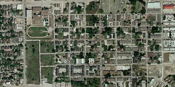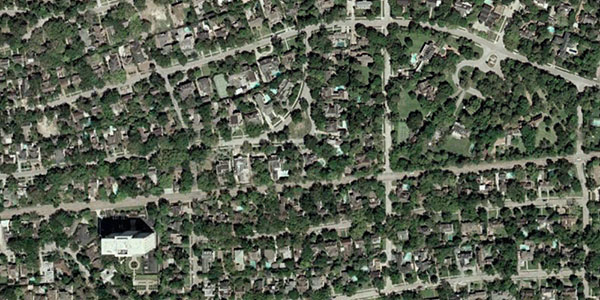
How? It's surprisingly simple. Turns out, demand for trees in neighborhoods behaves a lot like a luxury item, as opposed to a basic necessity.
Tim De Chant at The Per Square Mile blog wrote about research on this a couple of weeks ago. Then, he went out and found examples, using images from Google Earth.
Research published a few years ago shows a tight relationship between per capita income and forest cover.The trouble, as De Chant points out, is that the disparity here is about more than aesthetics. It's about air quality, cooling effects in the summer, and documented impacts on stress, crime, and quality of life. It's also interesting because it seems to go against the stereotype of wealthy suburbs where all vegetation has been eliminated in favor of houses.
...They found that for every 1 percent increase in per capita income, demand for forest cover increased by 1.76 percent. But when income dropped by the same amount, demand decreased by 1.26 percent. That’s a pretty tight correlation. The researchers reason that wealthier cities can afford more trees, both on private and public property. The well-to-do can afford larger lots, which in turn can support more trees. On the public side, cities with larger tax bases can afford to plant and maintain more trees.
That's Houston's Fourth Ward above, and River Oaks neighborhood below. But De Chant found satellite examples all over the United States, as well as in South America and China.


No comments:
Post a Comment