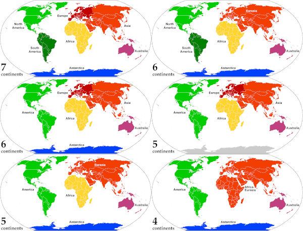
Animated, color-coded map showing the various continents and regions. Depending on the convention and model, some continents may be consolidated or subdivided: for example, Eurasia is most often subdivided into Europe and Asia (red shades), while North and South America are sometimes recognized as one American continent (green shades).
A continent is one of several very large landmasses on Earth. They are generally identified by convention rather than any strict criteria, with up to seven regions commonly regarded as continents. These are from largest in size to smallest: Asia, Africa, North America, South America, Antarctica, Europe, and Australia.
In geology, continents are described by means of tectonic plates. Plate tectonics is the process and study of the movement, collision and division of continents.
Read more here.


No comments:
Post a Comment