
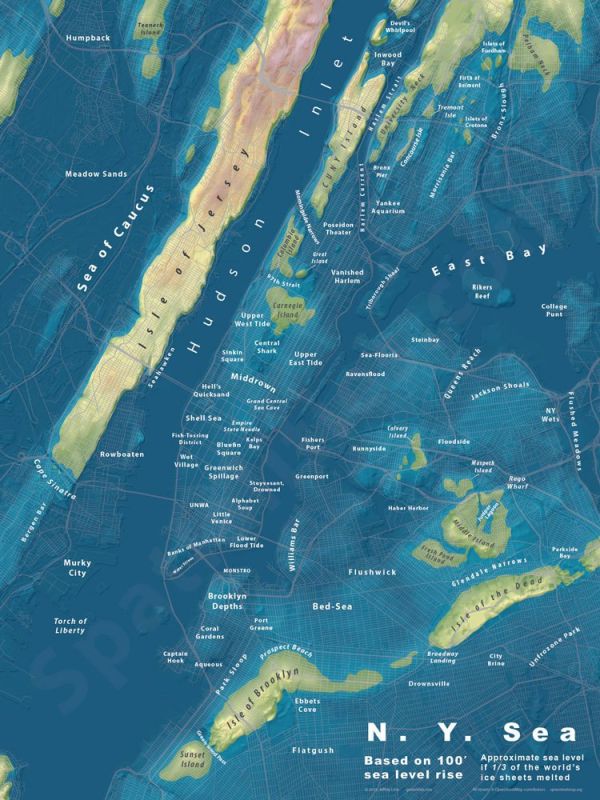
Jeffrey Linn, a designer and urban planner, made a series of maps illustrating how cities might appear if sea levels rose dramatically. The maps are also filled with tongue-in-cheek name changes for the waterlogged areas, such as "Central Shark," "Middrown" and "Flushwick" instead of Central Park, Midtown and Bushwick.
See the rest of the series, which includes Los Angeles, Seattle, Portland, London and other cities here. The artwork can be purchased in poster form, and can be ordered with and without the place names. Follow the artist on social media via Twitter.
No comments:
Post a Comment