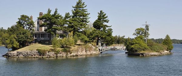
This
is Zavikon Island, one (or actually two) of the Thousand Islands
between New York and Ontario in the St. Lawrence River. You may have
seen this picture, with the bridge with flags attached, and the story
that the larger island is in Canada and the smaller island is in the
United States, causing the homeowner to become an international traveler
when visiting his/her other island. That’s not true.
According to Wikipedia,
The
smaller and more southeasterly of the pair of islands is sometimes
called Little Zavikon Island. It has a US-Canada Boundary Commission
reference monument, from which, along with other reference monuments on
the shore and islands, surveying measurement are used to calculate the
international boundary line turning points in the waterway (in this
case, about 140 meters southsoutheast of the southern tip of Little
Zavikon Island as shown on the largest scale USGS map of the area.
Google Maps shows that
the border does not run between the islands.
Reportedly, tour guides still beef up their patter with the tale of the
island divided by an internaitonal border, which is believable because
of flags decorating the bridge. But what a lovely place! You can see
a larger version of this picture at Wikipedia.


No comments:
Post a Comment