
NO COUNTRY FOR ANY MEN
The
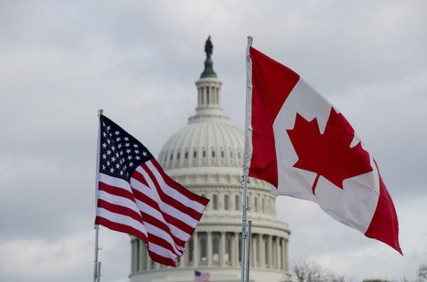
1783 Treaty of Paris ended the Revolutionary War, but it left in
question the exact border between the eastern United States and Canada,
which remained under British control. Until 1842, when the
Webster-Ashburton Treaty settled most of the questions, there were
swatches of land along the New York/Vermont/New Hampshire/Maine borders
that didn’t technically belong to either country. And in the 60 years
between the two treaties, at least three independent “republics” sprang
up in the region.
REPUBLIC OF UPPER CANADA
 Location: Navy Island in the Niagara River
 What happened: In December 1837, after unsuccessfully fighting to win independence from England, a Canadian rebel group led by journalist and former mayor of Toronto William Lyon Mackenzie fled to Navy Island above Niagara Falls, one of the areas that didn’t officially belong to either the United States or Canada (today it’s Canadian land). They declared the island to be a brand-new country, the Republic of Upper Canada. American sympathizers, still holding a grudge against the British after the War of 1812, supplied the rebels with food, weapons, and money via a steamship called the Caroline. The Republic of Upper Canada didn’t last long. In less than a month, British and Canadian loyalists had crossed into New York and captured the ship, setting it ablaze and loose to plummet over Niagara Falls. Mackenzie and his group withdrew from Navy Island in January 1838.
REPUBLIC OF INDIAN STREAM

Location: Between Quebec and New Hampshire
What happened: Indian Stream is a small tributary of the Connecticut River located near the small town of Pittsburg, New Hampshire, but in the early 1800s, it flowed through no-man’s-land. In the 1790s, two groups of Canadian settlers got land grants from the Abenaki people, one of the local Native American tribes, to move in. They didn’t take sides in the border disputes initially, but by the 1830s, both the British (who controlled Canada at the time) and American tax collectors came knocking. And so, not wanting to be taxed by either government, the 300 Indian Stream settlers proclaimed themselves the sole inhabitants of an independent country.
That lasted about three years. In 1835, after a sheriff from Canada “invaded” to arrest a man whom the British claimed owed them a tax debt, Indian Stream’s citizens fought back, freed the man from debtors’ prison, and ultimately joined New Hampshire.
 What happened:
In the early 1800s, an American settler named John Baker moved from
southern Maine into no-man’s land along the Maine/Quebec/New Brunswick
border. By 1827, Baker was so tired of waiting for the State of Maine to
rule that his house was in America (and not Canada) that he decided to
start his own country— the Republic of Madawaska, a Maliseet Indian term
that meant “where one river runs into another with watergrass.” This
proclamation was important to Baker because he was fed up with the
government, but it was more important to some of his neighbors, Acadians
who had been deported as a group from Canada in the mid-1700s because
they were the descendants of French Catholics, rather than British
Protestants. Although many Acadians immigrated to the American South and
become the “Cajuns” of New Orleans, many of Baker’s neighbors just
wanted a safe place to live that wasn’t in Canada, and so they were
happy to declare themselves citizens of the new republic.
What happened:
In the early 1800s, an American settler named John Baker moved from
southern Maine into no-man’s land along the Maine/Quebec/New Brunswick
border. By 1827, Baker was so tired of waiting for the State of Maine to
rule that his house was in America (and not Canada) that he decided to
start his own country— the Republic of Madawaska, a Maliseet Indian term
that meant “where one river runs into another with watergrass.” This
proclamation was important to Baker because he was fed up with the
government, but it was more important to some of his neighbors, Acadians
who had been deported as a group from Canada in the mid-1700s because
they were the descendants of French Catholics, rather than British
Protestants. Although many Acadians immigrated to the American South and
become the “Cajuns” of New Orleans, many of Baker’s neighbors just
wanted a safe place to live that wasn’t in Canada, and so they were
happy to declare themselves citizens of the new republic.
The British weren’t so happy about it, though. On the same day that Baker established his country, British troops from Canada arrested him and put him on trial for conspiracy and sedition. He was ultimately fined £25 and sentenced to prison until he paid it… or two months, whichever came first. This set off an international incident between Canada and the United States that lasted for 15 years. It even triggered a border conflict in 1838 and 1839 called the Aroostook War, which included a lot of diplomatic meetings, threats, shouting, militia-massing on both sides, and incendiary editorials… but no actual combat. Eventually, diplomats from London and Washington negotiated that Webster-Ashburton Treaty of 1842 to settle the northeastern Canada/United States border issue once and for all, and the Republic of Madawaska became part of the Canadian province of New Brunswick.
What happened: Indian Stream is a small tributary of the Connecticut River located near the small town of Pittsburg, New Hampshire, but in the early 1800s, it flowed through no-man’s-land. In the 1790s, two groups of Canadian settlers got land grants from the Abenaki people, one of the local Native American tribes, to move in. They didn’t take sides in the border disputes initially, but by the 1830s, both the British (who controlled Canada at the time) and American tax collectors came knocking. And so, not wanting to be taxed by either government, the 300 Indian Stream settlers proclaimed themselves the sole inhabitants of an independent country.
That lasted about three years. In 1835, after a sheriff from Canada “invaded” to arrest a man whom the British claimed owed them a tax debt, Indian Stream’s citizens fought back, freed the man from debtors’ prison, and ultimately joined New Hampshire.
REPUBLIC OF MADAWASKA
Location: Between Maine and New Brunswick What happened:
In the early 1800s, an American settler named John Baker moved from
southern Maine into no-man’s land along the Maine/Quebec/New Brunswick
border. By 1827, Baker was so tired of waiting for the State of Maine to
rule that his house was in America (and not Canada) that he decided to
start his own country— the Republic of Madawaska, a Maliseet Indian term
that meant “where one river runs into another with watergrass.” This
proclamation was important to Baker because he was fed up with the
government, but it was more important to some of his neighbors, Acadians
who had been deported as a group from Canada in the mid-1700s because
they were the descendants of French Catholics, rather than British
Protestants. Although many Acadians immigrated to the American South and
become the “Cajuns” of New Orleans, many of Baker’s neighbors just
wanted a safe place to live that wasn’t in Canada, and so they were
happy to declare themselves citizens of the new republic. The British weren’t so happy about it, though. On the same day that Baker established his country, British troops from Canada arrested him and put him on trial for conspiracy and sedition. He was ultimately fined £25 and sentenced to prison until he paid it… or two months, whichever came first. This set off an international incident between Canada and the United States that lasted for 15 years. It even triggered a border conflict in 1838 and 1839 called the Aroostook War, which included a lot of diplomatic meetings, threats, shouting, militia-massing on both sides, and incendiary editorials… but no actual combat. Eventually, diplomats from London and Washington negotiated that Webster-Ashburton Treaty of 1842 to settle the northeastern Canada/United States border issue once and for all, and the Republic of Madawaska became part of the Canadian province of New Brunswick.
FUTURE REPUBLICS?
Despite
mostly solving the problem by dividing up the border territories, the
treaty-makers missed a couple of spots. Even today, North Rock Island
and the Machias Seal Island in the Gulf of Maine are still in dispute—
though if you’re thinking of setting up settlements there, be aware that
both islands are barren and rocky, with lots of fog and no trees. North
Rock is only about the size of a football field and is full of seals.
Machias —bigger, but only 20 acres— includes an ancient lighthouse
staffed by two members of the Canadian Coast Guard, so expect armed
resistance to your plans… or at least polite objections.
No comments:
Post a Comment