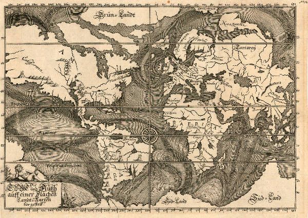
The
focus of this map from 1685 is the ocean currents, while we find the
land masses are the most interesting part. The proportions are strange,
but it’s pretty complete considering the measuring tools and methods
available at the time. The Mississippi River flows through Texas, and
Florida is missing, but the details of the coastlines are pretty
familiar. This map is part of a collection of historical graphs from the
British Library in an exhibit called
Beautiful Science: Picturing Data, Inspiring Insight. See more examples from the exhibit
at Buzzfeed.

No comments:
Post a Comment